
9 Best Hiking Trails Along Mount Baker Scenic Byway
This page contains affiliate links. Read the full disclaimer for more information.
If you’re planning to hike any of the trails on Mount Baker or along the Mount Baker Scenic Byway, you’re in for a real treat! Mount Baker has some stunning landscapes and is often less busy than other high-profile mountains in Washington state, like Mount Rainier that tends to have more tourists. Since I’m not much of a fan of crowds on trails, it ended up being an ideal spot for us.
Mount Baker is an active volcano covered in glaciers and Washington’s 3rd-largest mountain, standing at 10,781 feet tall. Its original name is Komo Kulshan, which was given to it by the Coast Salish peoples. There you’ll find an absolutely beautiful wilderness mixed with wildflower meadows, rivers, alpine climbs, skiing, and views of the mountain next door, Mount Shuksan.
The hiking trails are all accessible off the Mount Baker Scenic Byway (State Route 542, also referred to as Mount Baker Highway) and consist of treks easy enough for a stroller and pets and others with harder alpine climbs.
This guide covers the best trails for hiking in the Mount Baker Wilderness, organized by difficulty, with important trail stats like total miles, elevation, pet requirements, and the best season to visit for each trail. All trailheads require a Northwest Forest Pass ($5/day, $30/year) or a valid America the Beautiful pass ($80/year for access to ALL national parks).
Then we’ll get into how we planned our own little mini road trip to Mount Baker, including where we stayed, other places we checked out besides the trails, and most importantly, where we ate!
But first, a little disclaimer: The Mount Baker-Snoqualmie National Forest is located on the ancestral land of the Nooksack tribe, and many areas hold cultural and archaeological significance. The meadows are fragile and are slow to recover, so tread lightly. Stay on the trails, camp at least 200 feet from lakes and streams, store food in a away that animals can’t get into it, pack out all trash, and pack out human waste rather than burying it. And don’t forget to check current conditions on the Washington Trails Association before you go!
Best Easy Mount Baker Hikes
1. Picture Lake Path
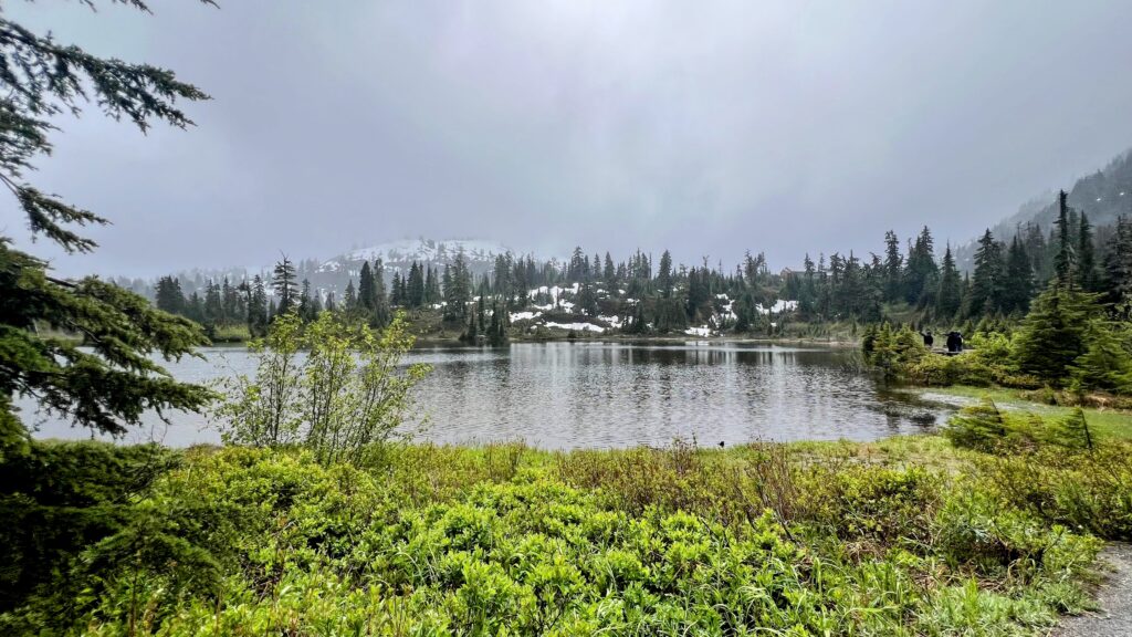
- Distance: 0.6 miles roundtrip
- Difficulty: Easy loop with a 6 ft elevation gain
- Best time to hike: Late June through October
- Pets allowed? Yes, but they must be on a leash and can’t enter the lake.
- Trailhead: Picture Lake parking area
This is the perfect hiking trail for beginners, if you’re bringing young ones, or you just want to enjoy the sights rather than take a long hike. It’s paved, ADA-accessible, and the view is especially unique, with the lake reflecting a the image of Mount Shuksan. It’s also only a 5-minute walk from the car (if that).
2. Horseshoe Bend
- Distance: 3.2 miles roundtrip
- Difficulty: Easy out-and-back hike with a 479 ft elevation gain
- Best time to hike: Year-round
- Pets allowed? Yes, but must be on a leash.
- Trailhead: Horseshoe Bend Trailhead, 2 miles past Glacier and across from the Douglas Fir Campground
Horseshoe Bend is the perfect hike for beginners who want an easy but longer hike. Since we went to Mount Baker in early June, there was still snow on most of the higher-elevation trails, but not on the Horseshoe Bend trail. This trail is best to visit any time of the year because of its lower elevation. The trail follows the North Fork Nooksack River through a mossy forest of old cedars, firs, and hemlocks. You’ll notice the trail eventually peters out, which is when you should turn around.
3. Artist Ridge Trail to Huntoon Point
- Distance: 1.5 miles roundtrip
- Difficulty: Easy out-and-back hike with a 269 ft elevation gain
- Best time: Late July through October
- Pets allowed? Yes, dogs are allowed but must be on a leash.
- Trailhead: Artist Point parking lot at the end of Mount Baker Highway
Artist Ridge trail is a fun short trail that comes with views of Mount Shuksan, Mount Baker, American Border Peak, Mount Larrabee, Goat Mountain, and Mount Stuart. Unfortunately, this trail is only accessible a few months out of the year and doesn’t usually melt until the end of June/beginning of July, so plan accordingly.
4. Bagley Lakes Loop
- Distance: 2 miles roundtrip
- Difficulty: Easy loop with a 262 ft elevation gain
- Best time: Late July through October
- Pets allowed? Yes, dogs are allowed but must be on a leash.
- Trailhead: Heather Meadows Visitor Center area
Bagley Lakes Loop trail is another great kid-friendly trail around the Bagley Lakes at Heather Meadows. It features stone bridges and some ridgelines that feel a little bit more dramatic than you’d think. It’s perfect for a chill morning hike when you still need energy for the rest of the day.
Best Moderate Mount Baker Hikes
5. Chain Lakes Loop
- Distance: 6.5 miles roundtrip
- Difficulty: Moderate loop with a 1,791 ft elevation gain
- Best time: Late July through mid-October
- Pets allowed? Yes, dogs are allowed but must be on a leash.
- Trailhead: Chain Lakes or Bagley Lakes Trailhead
This hike is definitely a harder trek than the previously mentioned ones, but still moderate and doable. The Chain Lakes Loop wraps around Table Mountain with amazing views of Mount Baker and Shuksan. Since it’s a loop, it’s also easy to only do a section of the trail if you don’t want to commit to the whole thing. Start at Heather Meadows and turn around at any of the lakes after getting the climbing out of the way.
6. Heliotrope Ridge
- Distance: 5.5 miles roundtrip
- Difficulty: Moderate out-and-back hike with a 1,850 ft elevation gain
- Best time: Early July through October
- Pets allowed? Yes, dogs are allowed but must be on a leash but maybe leave them at home if they aren’t used to the elevation and stream crossings.
- Trailhead: Heliotrope Ridge Trailhead (rough single-lane access road with potholes)
Heliotrope Ridge is a rewarding woodsy hike that’s perfect if you want to get up close and personal with Mount Baker and Coleman Glacier. Seriously, you can even hear the ice shifting in the glacier, which is pretty cool. You’ll also share the path with mountaineers heading up to summit Baker and there are a couple of stream crossings, so trekking poles are recommended for stability.
Best Hard Mount Baker Hikes
7. Lake Ann
- Distance: 8.2 miles roundtrip
- Difficulty: Hard out-and-back hike with a 2,150 ft elevation gain
- Best time: Late July through mid-October
- Pets allowed? Yes, dogs are allowed but must be on a leash but maybe leave them at home if they aren’t used to the elevation.
- Trailhead: Lake Ann Trailhead
The Lake Ann trail is perfect for meadow seekers and hardcore climbers alike. But be warned, this hike has a BRUTAL climb to Lake Ann, but it’s totally worth it, tucked beneath the face of Mount Shuksan with the Lower Curtis Glacier hanging above. If you’re able to start early enough, add a short detour toward the glacier and it stretches closer to 10 miles.
8. Skyline Divide
- Distance: 9 miles roundtrip
- Difficulty: Hard out-and-back hike with a 2,500 ft elevation gain
- Best time: Late July through mid-October
- Pets allowed? Yes, dogs are allowed but must be on a leash but maybe leave them at home if they aren’t used to the elevation.
- Trailhead: Skyline Divide Trailhead (rough forest access road)
Skyline Divide is loved by locals because of it’s ridgeline. You’ll start out in a forested climb that’ll bring you to a wide-open range full of summer wildflowers, adorable marmots, and majestic towering views of Mount Baker and Shuksan. Turn around whenever you want or extend it into a longer backpacking trip if that’s more your speed.
9. Yellow Aster Butte
- Distance: 8.4 miles roundtrip
- Difficulty: Hard out-and-back hike with a 2,800 ft elevation gain
- Best time: Mid-July through mid-October
- Pets allowed? Yes, dogs are allowed but must be on a leash but maybe leave them at home if they aren’t used to the elevation.
- Trailhead: Yellow Aster Butte Trailhead (last few miles are on a rough and potholed dirt road)
This trail is known to many as one of the most beautiful and colorful trails in the Mount Baker Wilderness. You’ll see wildflower gardens that emit beautiful autumn colors witha 360-degree panorama of Mount Baker and Shuksan. It’s steep and demanding, but beautiful enough to swallow the pain. There’s also camping nearby but it’s full up by the middle of the day, so start early!
Our Mini Road Trip to Mount Baker (Where We Stayed, Ate, and Explored)
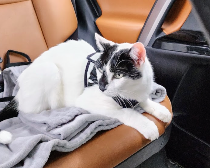
Before we planned on doing any hiking along Mount Baker Highway, we needed a home base for a few days that wasn’t a camp ground since we brought our cat, Mew (and he hasn’t done much camping yet).
We also LOVE food and always try to find new places to eat wherever we go, so we wanted a place with easy access to food.
Driving From Tacoma to Mount Baker
Since we were driving to Mount Baker from Tacoma, we took I-5 North through Seattle and Everett to Bellingham, where we got off on exit 255 to hop onto the Mount Baker Highway. Then it was just a straight shot from there to our Airbnb.
If you’re coming across the Puget Sound from the Olympic or Kitsap Peninsulas, you can take one of the Washington Ferries to get over to the mainland (Bremerton, Southworth, Bainbridge, or Port Townsend ferries come into Seattle and north of Seattle).
Home Base: A Maple Falls Airbnb
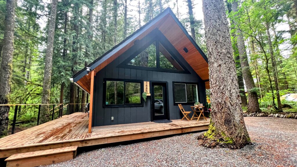
We found an adorable Airbnb nestled in a forest in Maple Falls, but still close to a few food places. It was also tailored to people with pets (both cats and dogs), so Mew was very satisfied. Renting an Airbnb here instead of staying somewhere in Bellingham put us within easy reach of the trailheads each morning.
Nooksack Falls
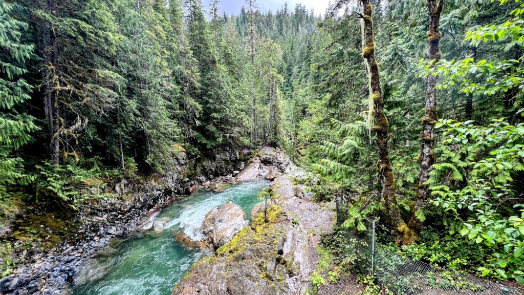
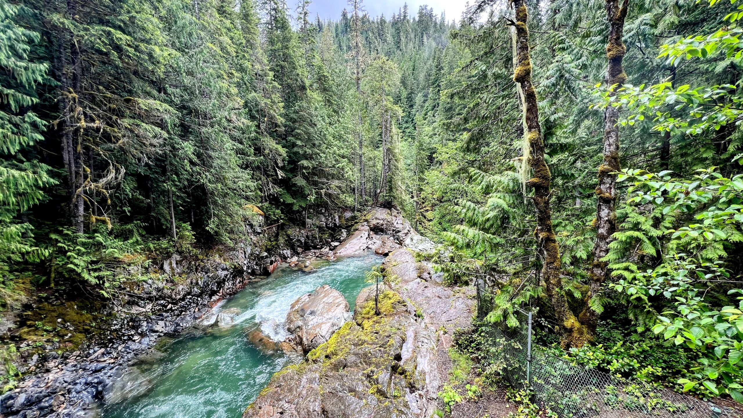
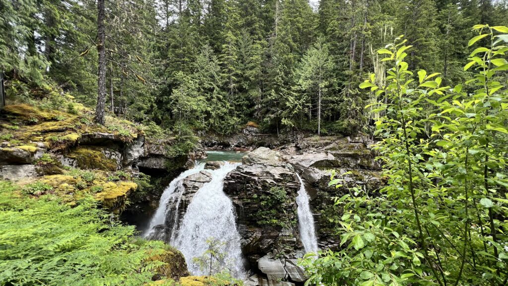
Just off the Mount Baker Scenic Byway near Glacier, a short road leads to Nooksack Falls, where the North Fork of the Nooksack drops 88 feet into a rocky canyon. It’s a couple of minutes’ walk from the car or an easy add-on before or after a hike. Remember to stay behind the fencing when viewing the falls!
Heather Meadows
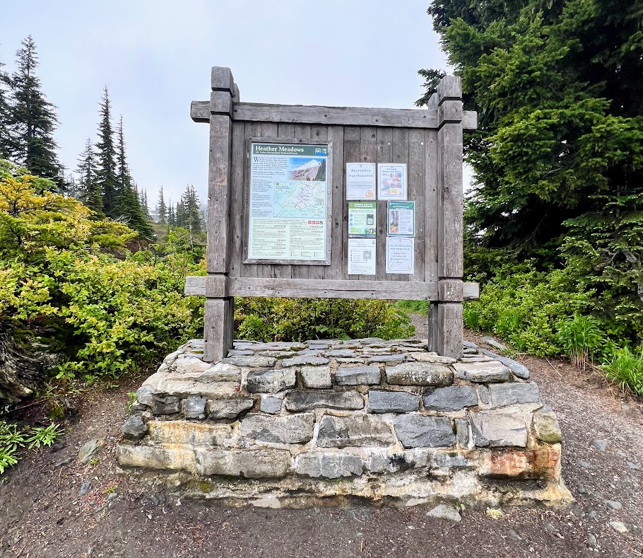
We used Heather Meadows as a hub to get trail info and get a feel for which trail we wanted to try, mostly because since we were there the beginning of June, this was where the Mount Baker Highway was closed off at because of the snow. So even though the visitor center wasn’t open (it opens mid-July), we still had everying we needed in terms of info from the trailhead sign.
Hiking the Horseshoe Bend Trail
The Horseshoe Bend Trail was our easygoing first hike. Riverside forests are some of our favorite areas to explore because we love looking at rocks for crystals and wanted to stay away from the trails that had more snow at the time. This was also super close to our Airbnb.
Eating at Wake ‘n Bakery
The Wake ‘n Bakery is the BEST place for breakfast on Mount Baker Highway. It was only a few minutes from our Airbnb in Glacier and has the best breakfast burritos (the chorizo breakfast burrito is to die for, and yes, it’s the “real” type of chorizo). But be warned, it’s a small place so you have to get there early before they sell out.
Where to Next in Washington?
Mount Baker barely scratches the surface of all that Washington has to offer. It’s the creme de la creme of the Pacific Northwest! So don’t just stop there.
Pair your trip with our Seattle to Olympic National Park Road Trip Guide or a Bainbridge Island day trip by heading down to Whidbey Island and hopping on the Coupeville ferry over to the Olympic Peninsula. There are also tons of fun things to do on Whidbey Island for a day trip in between.
Heading further south afterward? Our Pacific Coast Highway road trip itinerary picks up the coastline through Oregon and California.
Which of these Mount Baker hiking trails are you most excited to tackle or have already mastered? Tell us in the comments!
Read more hiking trail guides:
- Hiking in Missouri: 5 Supreme Spots for The Perfect Missouri Day Hike
- Hiking the Indian Staircase Trail: An Off-Trail Adventure in Red River Gorge
- 7 Best Hikes Near Denver That Locals Will Tell You About
- Why Sky Pond Trail in Rocky Mountain National Park is One of the Best Hikes In Colorado
Pin it for later!

Dani is an entrepreneur and one of the creators of hikingandroadtrips.com. She is obsessed with everything outdoors, especially hiking, traveling and will take any opportunity to #getoutside for adventure or to just vibe with the earth.